
Tabula Peutingeriana – Single display of hits
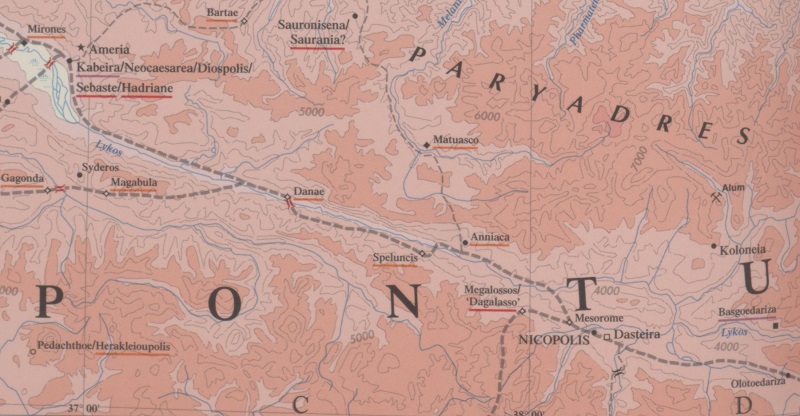
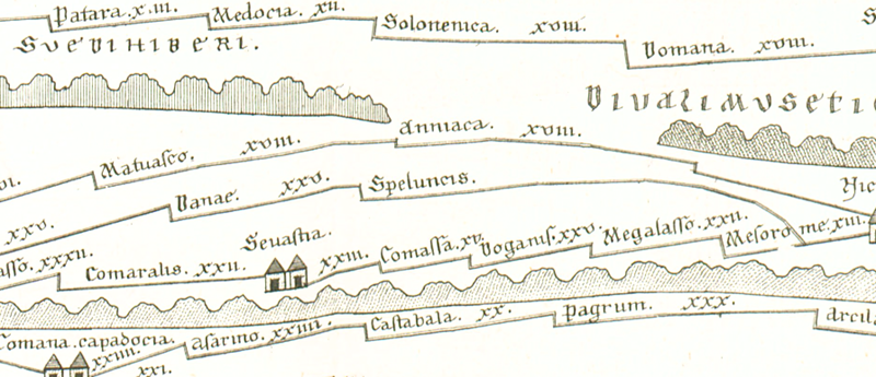
| Toponym TP (renewed): | Speluncis |
| Name (modern): | ? Karawansarei nahe Eski Kale, Koyulhisar |
| Image: | 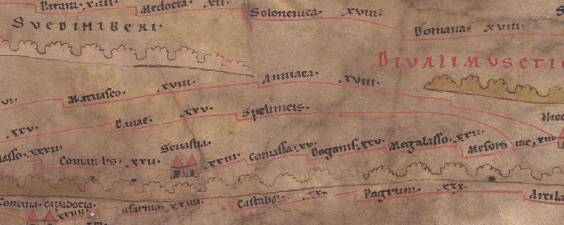 To the image detail |
| Toponym before | XXV Danae |
| Toponym following | - Mesorome |
| Alternative Image | --- |
| Image (Barrington 2000) |
 |
| Image (Scheyb 1753) |
 |
| Image (Welser 1598) | --- |
| Image (MSI 2025) | --- |
| Pleiades: | https://pleiades.stoa.org/places/857332 |
| Area: | Asia Minor |
| Toponym Type: | Toponym, no Symbol |
| Grid square: | 9A4 / 9A5 |
| Toponym Color: | black |
| Vignette Type : | --- |
| Itinerary: |
|
| Alternative Name (Lexica): |
|
| Name A (RE): | Speluncae 2 |
| Name B (Barrington Atlas): | Speluncis (87 C4) |
| Name C (TIR/TIB/others): |
|
| Name D (Miller): | Speluncis |
| Name E (Levi): |
|
| Name F (Ravennate): |
|
| Name G (Ptolemy): |
|
| Plinius: |
|
| Strabo: |
|
| Dating from Toponym on TP: | Roman Republic |
| Argument for Dating: | Datierung: Der lateinische Name verweist auf die Zeit der römischen Präsenz in der Region ab dem 1. Jh. v. Chr. |
| Commentary on the Toponym: |
Der Name (lat. “= Höhlen”) ist für diesen Ort nur hier belegt. |
| References: |
Bryer, A. A. M./Winfield, D. C.: The Byzantine monuments and topography of the Pontos, 2 Bde., Washington DC 1985, 23f. |
| Last Update: | 18.08.2025 17:25 |
Cite this page:
https://www1.ku.de/ggf/ag/tabula_peutingeriana/trefferanzeige_en.php?id=1384 [last accessed on July 1, 2026]