
Tabula Peutingeriana – Single display of hits
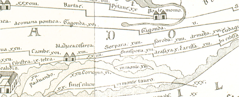
| Toponym TP (renewed): | Sorpara |
| Name (modern): |
|
| Image: | 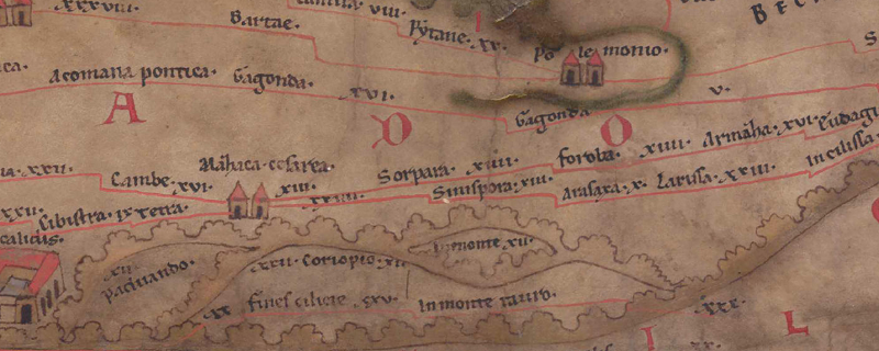 To the image detail |
| Toponym before | XIII Mazaca Caesarea |
| Toponym following | XIIII Foroba |
| Alternative Image | --- |
| Image (Barrington 2000) |
 |
| Image (Scheyb 1753) |
 |
| Image (Welser 1598) | --- |
| Image (MSI 2025) | --- |
| Area: | Asia Minor |
| Toponym Type: | Toponym, no Symbol |
| Grid square: | 9B3 |
| Toponym Color: | black |
| Vignette Type : | --- |
| Itinerary: |
|
| Alternative Name (Lexica): |
|
| Name A (RE): | Sorpara |
| Name B (Barrington Atlas): |
|
| Name C (TIR/TIB/others): |
|
| Name D (Miller): | Sorpara |
| Name E (Levi): |
|
| Name F (Ravennate): |
|
| Name G (Ptolemy): | ? = Σόβαρα (5,6,15) |
| Plinius: |
|
| Strabo: |
|
| Dating from Toponym on TP: | --- |
| Argument for Dating: |
|
| Commentary on the Toponym: |
Straßenstation an der Route von Mazaka Caesarea in Richtung Nordosten nach Sebasteia (9B4 Seuastia), die in osman. und byzantin. Zeit strategisch bedeutend war (s. Hild 1977, 71). |
| References: |
Hild, Friedrich: Das byzantinische Straßensystem in Kappadokien (= Denkschriften philosophisch-historischen Klasse 131), Wien 1977, 71-76. |
| Last Update: | 19.08.2025 17:52 |
Cite this page:
https://www1.ku.de/ggf/ag/tabula_peutingeriana/trefferanzeige_en.php?id=1396 [last accessed on June 4, 2026]