
Tabula Peutingeriana – Pantalla individual
| Topónimo (simplificado): | Silesua |
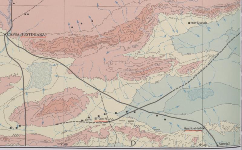
| Nombre (moderno): | Biar bou Loufa (Barrington) / Hr. el Djerbi (Gasr el Haira). (Miller) |
| Imagen: | 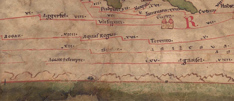 Al detalle de la imagen |
| Topónimo antes | - (unnamed / illegible, no. T) |
| Topónimo después | XVIIII Ad Aquas XVIII Avibus |
| Imagen alternativa | --- |
| Imagen (Barrington 2000) |
 |
| Imagen (Scheyb 1753) | --- |
| Imagen (Welser 1598) | --- |
| Imagen (MSI 2025) | --- |
| Pleiades: | https://pleiades.stoa.org/places/324813 |
| Área: | África Proconsular |
| Tipo de topónimo: | Topónimo sin símbolo |
| Cuadrícula: | 5C2 |
| Color del topónimo: | negro |
| Tipo de viñeta: | --- |
| Itinerario: |
|
| Nombres alternativos (diccionarios): |
|
| Nombre A (RE): | Silesva |
| Nombre B (Barrington Atlas): | Silesva? (33 E4) |
| Nombre C (TIR / TIB /otros): |
|
| Nombre D (Miller): | Silesua |
| Nombre E (Levi): |
|
| Nombre F (Ravenate): | Selesua (p. 38.23) |
| Nombre G (Ptolemaios): |
|
| Plinius: |
|
| Strabo: |
|
| Datación del topónimo en la TP: | --- |
| Fundamento para la datación: |
|
| Comentario al topónimo: |
Kommentar (Talbert): |
| Bibliografía: | Miller, Itineraria, Sp. 922. 924; [Standard-Literatur-Liste im PDF-Format] |
| Última elaboración: | 27.02.2025 11:00 |
Cite this page:
https://www1.ku.de/ggf/ag/tabula_peutingeriana/trefferanzeige_es.php?id=1358 [zuletzt aufgerufen am 17.11.2025]