
Tabula Peutingeriana – Pantalla individual
| Topónimo (simplificado): | Portunamnetv (Portu Namnetu) |
| Nombre (moderno): | Nantes |
| Imagen: | 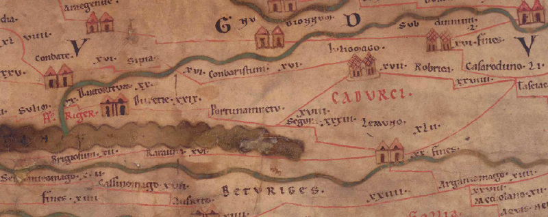 Al detalle de la imagen |
| Topónimo antes | XXIX Duretie |
| Topónimo después | XVIII (?) Iuliomago - (?) Segvra (Segura) |
| Imagen alternativa | --- |
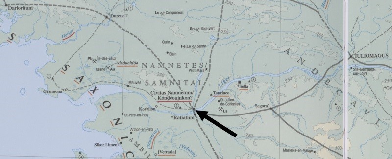
| Imagen (Barrington 2000) |
 |
| Imagen (Scheyb 1753) | --- |
| Imagen (Welser 1598) | --- |
| Imagen (MSI 2025) | --- |
| Área: | Galia/Germania |
| Tipo de topónimo: | Topónimo sin símbolo |
| Cuadrícula: | 1B2 / 1B3 |
| Color del topónimo: | negro |
| Tipo de viñeta: | --- |
| Itinerario: |
|
| Nombres alternativos (diccionarios): | Portus Nemetum (DNP) |
| Nombre A (RE): | Portus Namnetum |
| Nombre B (Barrington Atlas): | Civitas Namnetum/Kondeouinkon? (14 D1) |
| Nombre C (TIR / TIB /otros): |
|
| Nombre D (Miller): | Portunamnetu |
| Nombre E (Levi): |
|
| Nombre F (Ravenate): |
|
| Nombre G (Ptolemaios): | Κονδηούινκον (2,8,9) |
| Plinius: |
|
| Strabo: |
|
| Datación del topónimo en la TP: | --- |
| Fundamento para la datación: |
|
| Comentario al topónimo: |
Kommentar (Talbert): |
| Bibliografía: |
Miller, Itineraria, Sp. 116. 117. |
| Última elaboración: | 01.03.2024 11:15 |
Cite this page:
https://www1.ku.de/ggf/ag/tabula_peutingeriana/trefferanzeige_es.php?id=3132 [zuletzt aufgerufen am 13.11.2025]