
Tabula Peutingeriana – Einzelanzeige
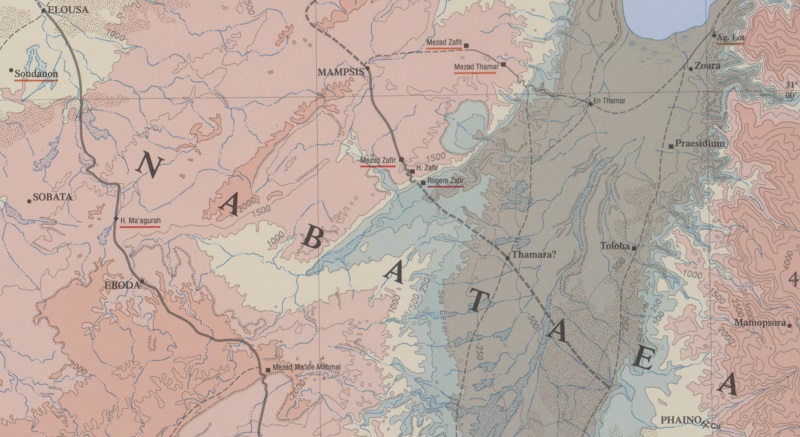
| Toponym TP (aufgelöst): | Thamaro |
| Name (modern): |
|
| Bild: | 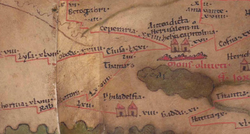 Zum Bildausschnitt auf der gesamten TP |
| Toponym vorher | LXVIIII Rababatora |
| Toponym nachher | LIII Elusa |
| Alternatives Bild | --- |
| Bild (Barrington 2000) |
 |
| Bild (Scheyb 1753) | --- |
| Bild (Welser 1598) | --- |
| Bild (MSI 2025) | --- |
| Pleiades: | https://pleiades.stoa.org/places/688039 |
| Großraum: | Syrien/Palästina/Arabien |
| Toponym Typus: | Ortsname ohne Symbol |
| Planquadrat: | 9C1 |
| Farbe des Toponyms: | schwarz |
| Vignette Typus : | --- |
| Itinerar (ed. Cuntz): |
|
| Alternativer Name (Lexika): |
|
| RE: | Thamara [2] - https://elexikon.ch/RE/VA,1_1233 |
| Barrington Atlas: | Thamara? (70 G4) |
| TIR / TIB /sonstiges: |
|
| Miller: | Thamaro |
| Levi: |
|
| Ravennat: |
|
| Ptolemaios (ed. Stückelberger / Grasshoff): |
|
| Plinius: |
|
| Strabo: |
|
| Autor (Hellenismus / Späte Republik): |
|
| Datierung des Toponyms auf der TP: | --- |
| Begründung zur Datierung: |
|
| Kommentar zum Toponym: |
Kommentar (Talbert): |
| Literatur: |
Miller, Itineraria, Sp. 836; |
| Letzte Bearbeitung: | 08.03.2026 17:57 |
Cite this page:
https://www1.ku.de/ggf/ag/tabula_peutingeriana/einzelanzeige.php?id=2902 [zuletzt aufgerufen am 17.07.2026]