Tabula Peutingeriana – Einzelanzeige
| Toponym TP (aufgelöst): | Anniaca |
| Name (modern): | ? Koyulhisar, Eski Kale |
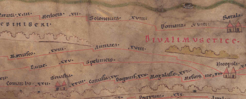
| Bild: |  Zum Bildausschnitt auf der gesamten TP |
| Toponym vorher | XVIII Matuasco |
| Toponym nachher | XVIII Nicopoli |
| Alternatives Bild | --- |
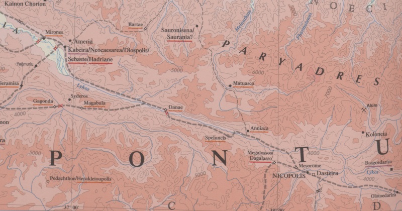
| Bild (Barrington 2000) |
 |
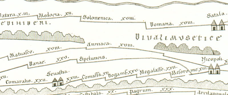
| Bild (Scheyb 1753) |
 |
| Bild (Welser 1598) | --- |
| Bild (MSI 2025) | --- |
| Pleiades: | https://pleiades.stoa.org/places/857030 |
| Großraum: | Asia Minor |
| Toponym Typus: | Ortsname ohne Symbol |
| Planquadrat: | 9A4 / 9A5 |
| Farbe des Toponyms: | schwarz |
| Vignette Typus : | --- |
| Itinerar (ed. Cuntz): |
|
| Alternativer Name (Lexika): |
|
| RE: | Anniaca (?) |
| Barrington Atlas: | Anniaca (87 C4) |
| TIR / TIB /sonstiges: |
|
| Miller: | Anniaca |
| Levi: |
|
| Ravennat: |
|
| Ptolemaios (ed. Stückelberger / Grasshoff): |
|
| Plinius: |
|
| Strabo: |
|
| Autor (Hellenismus / Späte Republik): |
|
| Datierung des Toponyms auf der TP: | --- |
| Begründung zur Datierung: |
|
| Kommentar zum Toponym: |
Ort im Pontos Polemoniakos oder in Armenia minor an der von Nikopolis nach Polemonion führenden Strasse Bergstaße über die Pontischen Alpen, 34 Meilen von letzterem, im Tal des Lykos, des heutigen Kelkit Çayı (s. Hirschfeld, RE 2257; Bryer/Winfield 1985, 44). |
| Literatur: |
Bryer, A. A. M./Winfield, D. C.: The Byzantine monuments and topography of the Pontos, 2 Bde., Washington DC 1985, 1, 43f, 116. |
| Letzte Bearbeitung: | 15.08.2025 10:35 |
Cite this page:
https://www1.ku.de/ggf/ag/tabula_peutingeriana/trefferanzeige.php?id=1353 [zuletzt aufgerufen am 25.02.2026]