
Tabula Peutingeriana – Einzelanzeige
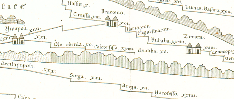
| Toponym TP (aufgelöst): | Analiba |
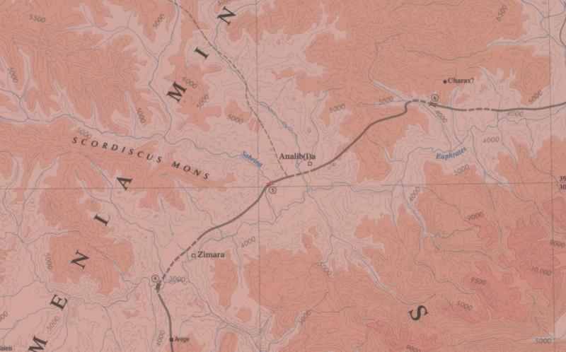
| Name (modern): | ? Hasanova ? |
| Bild: | 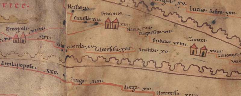 Zum Bildausschnitt auf der gesamten TP |
| Toponym vorher | XXIIII Caleorsissa |
| Toponym nachher | XV Zimara |
| Alternatives Bild | --- |
| Bild (Barrington 2000) |
 |
| Bild (Scheyb 1753) |
 |
| Bild (Welser 1598) | --- |
| Bild (MSI 2025) | --- |
| Pleiades: | https://pleiades.stoa.org/places/628922 |
| Großraum: | Asia Minor |
| Toponym Typus: | Ortsname ohne Symbol |
| Planquadrat: | 10B1 |
| Farbe des Toponyms: | schwarz |
| Vignette Typus : | --- |
| Itinerar (ed. Cuntz): | Analiba (208,4) |
| Alternativer Name (Lexika): |
|
| RE: | Analiba |
| Barrington Atlas: | Analib(l)a (64 H1) |
| TIR / TIB /sonstiges: |
|
| Miller: | Analiba |
| Levi: |
|
| Ravennat: |
|
| Ptolemaios (ed. Stückelberger / Grasshoff): | Ἀνάλιβλα (5,7,4) |
| Plinius: |
|
| Strabo: |
|
| Autor (Hellenismus / Späte Republik): |
|
| Datierung des Toponyms auf der TP: | --- |
| Begründung zur Datierung: | Belegt seit Ptol. und in spätantiken Quellen. |
| Kommentar zum Toponym: |
Lag in Wirklichkeit südöstl. der voraufgehenden Station Caleorissa und nordöstl. der Folgestation Zimara (heute: Pingan). Auf der TP liegt Analiba, anders als im ItAnt (s. u.), auf einer Verbindung von 9A5 Nicopoli nach Zimara (und zwar 15 Meilen vor Zimara), wahrscheinlich ein Irrtum, wie auch das Fehlen der roten Straßenlinie nahelegt (s. Mitford 2018, vol. 1, 257). |
| Literatur: |
Bryer, A. A. M./Winfield, D. C.: The Byzantine monuments and topography of the Pontos, 2 Bde., Washington DC 1985, 25; 31f. |
| Letzte Bearbeitung: | 20.09.2025 16:53 |
Cite this page:
https://www1.ku.de/ggf/ag/tabula_peutingeriana/trefferanzeige.php?id=1671 [zuletzt aufgerufen am 26.07.2026]