
Tabula Peutingeriana – Einzelanzeige
| Toponym TP (aufgelöst): | Lacus Beberaci |
| Name (modern): |
|
| Bild: | 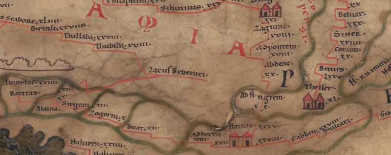 Zum Bildausschnitt auf der gesamten TP |
| Toponym vorher | XVIII Thubida - (unnamed / illegible, no. 67) |
| Toponym nachher | |
| Alternatives Bild | --- |
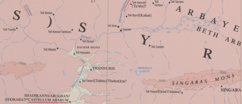
| Bild (Barrington 2000) |
 |
| Bild (Scheyb 1753) | --- |
| Bild (Welser 1598) | --- |
| Bild (MSI 2025) | --- |
| Pleiades: | https://pleiades.stoa.org/places/874399 |
| Großraum: | Asien östl. d. Euphrat, südl. d. Taurus |
| Toponym Typus: | Ortsname ohne Symbol |
| Planquadrat: | 10B4 |
| Farbe des Toponyms: | schwarz |
| Vignette Typus : | --- |
| Itinerar (ed. Cuntz): |
|
| Alternativer Name (Lexika): |
|
| RE: | Beberaci lacus - https://elexikon.ch/RE/III,1_181.png |
| Barrington Atlas: | Beberaci L. (89 D4 (lake)) |
| TIR / TIB /sonstiges: |
|
| Miller: |
|
| Levi: |
|
| Ravennat: |
|
| Ptolemaios (ed. Stückelberger / Grasshoff): |
|
| Plinius: |
|
| Strabo: |
|
| Autor (Hellenismus / Späte Republik): |
|
| Datierung des Toponyms auf der TP: | --- |
| Begründung zur Datierung: |
|
| Kommentar zum Toponym: |
Kommentar (Talbert): |
| Literatur: |
Miller, Itineraria, Sp. 781; |
| Letzte Bearbeitung: | 20.08.2025 21:14 |
Cite this page:
https://www1.ku.de/ggf/ag/tabula_peutingeriana/trefferanzeige.php?id=1785 [zuletzt aufgerufen am 25.07.2026]