
Tabula Peutingeriana – Einzelanzeige
| Toponym TP (aufgelöst): | Statule |
| Name (modern): | westlich von Goriano Sicoli [3] |
| Bild: | 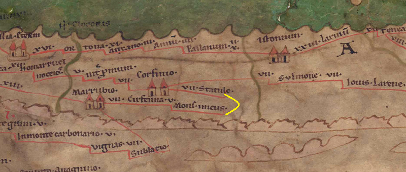 Zum Bildausschnitt auf der gesamten TP |
| Toponym vorher | VII Corfinio |
| Toponym nachher | - Mons Imeus |
| Alternatives Bild |
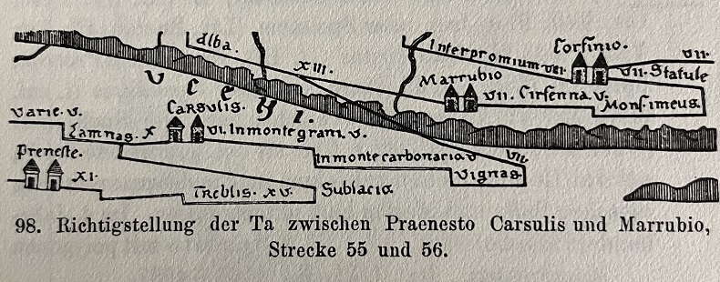 |
| Bild (Barrington 2000) |
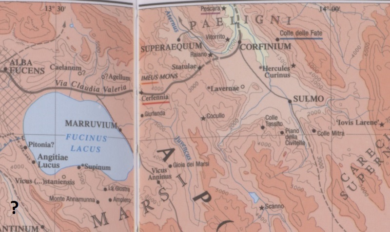 |
| Bild (Scheyb 1753) | --- |
| Bild (Welser 1598) | --- |
| Bild (MSI 2025) | --- |
| Pleiades: | https://pleiades.stoa.org/places/413322 |
| Großraum: | Italien |
| Toponym Typus: | Ortsname ohne Symbol |
| Planquadrat: | 5B2 |
| Farbe des Toponyms: | schwarz |
| Vignette Typus : | --- |
| Itinerar (ed. Cuntz): |
|
| Alternativer Name (Lexika): |
|
| RE: | Statulae - https://elexikon.ch/RE/IIIA,2_2233.png |
| Barrington Atlas: | Statulae (42 F4) |
| TIR / TIB /sonstiges: |
|
| Miller: | Statule |
| Levi: |
|
| Ravennat: |
|
| Ptolemaios (ed. Stückelberger / Grasshoff): |
|
| Plinius: |
|
| Strabo: |
|
| Autor (Hellenismus / Späte Republik): |
|
| Datierung des Toponyms auf der TP: | bislang nicht bestimmbar |
| Begründung zur Datierung: | Fehlende literarische oder epigraphische Belege. |
| Kommentar zum Toponym: |
[PK: warum endet die Strecke im Nichts mit einem Haken, eigentlich müsste es weiter gehen nach Mons imeus laut BAtlas]. |
| Literatur: |
[1] Cuntz, Topographische Studien |
| Letzte Bearbeitung: | 26.10.2025 19:03 |
Cite this page:
https://www1.ku.de/ggf/ag/tabula_peutingeriana/trefferanzeige.php?id=333 [zuletzt aufgerufen am 25.07.2026]