
Tabula Peutingeriana – Einzelanzeige
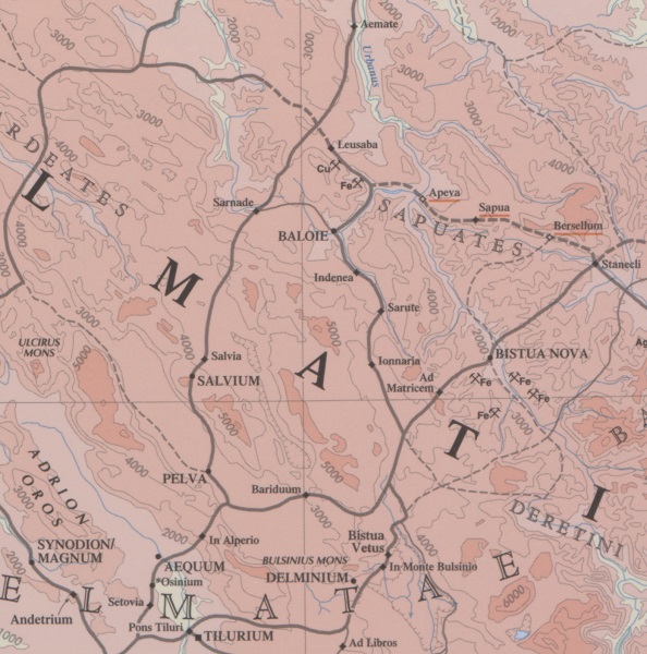
| Toponym TP (aufgelöst): | Ionnaria |
| Name (modern): | Stubo-Vrelo |
| Bild: | 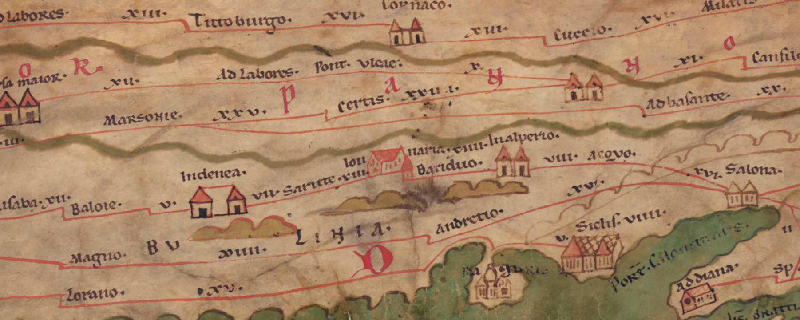 Zum Bildausschnitt auf der gesamten TP |
| Toponym vorher | XIII Sarute |
| Toponym nachher | XIIII Bariduo |
| Alternatives Bild | --- |
| Bild (Barrington 2000) |
 |
| Bild (Scheyb 1753) | --- |
| Bild (Welser 1598) | --- |
| Bild (MSI 2025) | --- |
| Pleiades: | https://pleiades.stoa.org/places/197324 |
| Großraum: | Balkanraum nördlich |
| Toponym Typus: | Ortsname mit Symbol |
| Planquadrat: | 5A2 |
| Farbe des Toponyms: | schwarz |
| Vignette Typus : | B Haus |
| Itinerar (ed. Cuntz): |
|
| Alternativer Name (Lexika): |
|
| RE: | Ionnaria |
| Barrington Atlas: | Ionnaria (20 E5) |
| TIR / TIB /sonstiges: |
|
| Miller: | Jonnaria |
| Levi: | Jonnaria (B,32) |
| Ravennat: |
|
| Ptolemaios (ed. Stückelberger / Grasshoff): |
|
| Plinius: |
|
| Strabo: |
|
| Autor (Hellenismus / Späte Republik): |
|
| Datierung des Toponyms auf der TP: | --- |
| Begründung zur Datierung: |
|
| Kommentar zum Toponym: |
Ungewöhnliche Vignette in Rot, die aus der Straßenlinie herzugehen scheint. Sie deutet einen Häuserkomplex an lt. Fluss, RE 133. |
| Literatur: |
Bojanovski, Ivo: Dolabelin sistem cesta u rimskoj provinciji Dalmaciji / Dolabellae systema viarum in provincia romana Dalmatia, Djela ANUBiH 47, Sarajevo 1974, 118f. |
| Letzte Bearbeitung: | 26.08.2025 11:14 |
Cite this page:
https://www1.ku.de/ggf/ag/tabula_peutingeriana/trefferanzeige.php?id=740 [zuletzt aufgerufen am 26.07.2026]