
Tabula Peutingeriana – Single display of hits
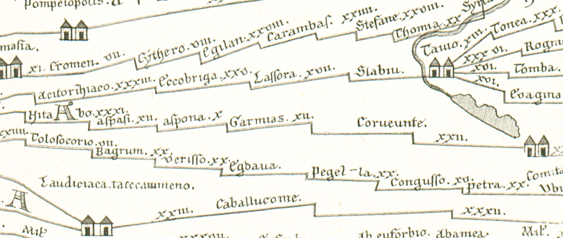
| Toponym TP (renewed): | Garmias |
| Name (modern): |
|
| Image: | 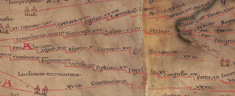 To the image detail |
| Toponym before | X Aspona |
| Toponym following | XII Corueunte (Corveunte) |
| Alternative Image | --- |
| Image (Barrington 2000) |
 |
| Image (Scheyb 1753) |
 |
| Image (Welser 1598) | --- |
| Image (MSI 2025) | --- |
| Pleiades: | https://pleiades.stoa.org/places/622140 |
| Area: | Asia Minor |
| Toponym Type: | Toponym, no Symbol |
| Grid square: | 8B5 |
| Toponym Color: | black |
| Vignette Type : | --- |
| Itinerary: |
|
| Alternative Name (Lexica): |
|
| Name A (RE): | Garmias |
| Name B (Barrington Atlas): | Garmias/‘Karima’ (63 unlocated) |
| Name C (TIR/TIB/others): |
|
| Name D (Miller): | Garmias |
| Name E (Levi): |
|
| Name F (Ravennate): | Carmas (p. 29,4) |
| Name G (Ptolemy): | ? Κάριμα (5,4,8) |
| Plinius: |
|
| Strabo: |
|
| Dating from Toponym on TP: | Roman Imperial Period (2nd century) |
| Argument for Dating: | Ort seit Ptol. belegt. |
| Commentary on the Toponym: |
Namensform nur hier belegt. |
| References: |
Hild, Friedrich: Das byzantinische Straßensystem in Kappadokien (= Denkschriften philosophisch-historischen Klasse 131), Wien 1977, 38. |
| Last Update: | 15.07.2025 16:55 |
Cite this page:
https://www1.ku.de/ggf/ag/tabula_peutingeriana/trefferanzeige_en.php?id=1248 [last accessed on June 4, 2026]