Tabula Peutingeriana – Single display of hits
| Toponym TP (renewed): | Analiba |
| Name (modern): | ? Hasanova ? |
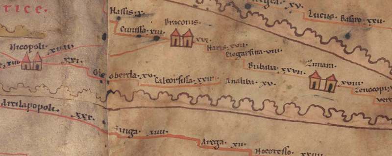
| Image: |  To the image detail |
| Toponym before | XXIIII Caleorsissa |
| Toponym following | XV Zimara |
| Alternative Image | --- |
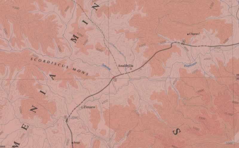
| Image (Barrington 2000) |
 |
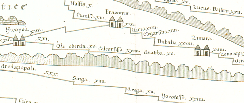
| Image (Scheyb 1753) |
 |
| Image (Welser 1598) | --- |
| Image (MSI 2025) | --- |
| Pleiades: | https://pleiades.stoa.org/places/628922 |
| Area: | Asia Minor |
| Toponym Type: | Toponym, no Symbol |
| Grid square: | 10B1 |
| Toponym Color: | black |
| Vignette Type : | --- |
| Itinerary: | Analiba (208,4) |
| Alternative Name (Lexica): |
|
| Name A (RE): | Analiba |
| Name B (Barrington Atlas): | Analib(l)a (64 H1) |
| Name C (TIR/TIB/others): |
|
| Name D (Miller): | Analiba |
| Name E (Levi): |
|
| Name F (Ravennate): |
|
| Name G (Ptolemy): | Ἀνάλιβλα (5,7,4) |
| Plinius: |
|
| Strabo: |
|
| Dating from Toponym on TP: | --- |
| Argument for Dating: | Belegt seit Ptol. und in spätantiken Quellen. |
| Commentary on the Toponym: |
Lag in Wirklichkeit südöstl. der voraufgehenden Station Caleorissa und nordöstl. der Folgestation Zimara (heute: Pingan). Auf der TP liegt Analiba, anders als im ItAnt (s. u.), auf einer Verbindung von 9A5 Nicopoli nach Zimara (und zwar 15 Meilen vor Zimara), wahrscheinlich ein Irrtum, wie auch das Fehlen der roten Straßenlinie nahelegt (s. Mitford 2018, vol. 1, 257). |
| References: |
Bryer, A. A. M./Winfield, D. C.: The Byzantine monuments and topography of the Pontos, 2 Bde., Washington DC 1985, 25; 31f. |
| Last Update: | 20.09.2025 16:53 |
Cite this page:
https://www1.ku.de/ggf/ag/tabula_peutingeriana/trefferanzeige_en.php?id=1671 [last accessed on January 5, 2026]