
Tabula Peutingeriana – Single display of hits
| Toponym TP (renewed): | Ad birium (Ad Birium) |
| Name (modern): | Maiorana |
| Image: | 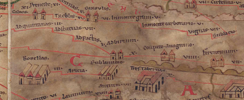 To the image detail |
| Toponym before | V Ad pactas (Ad Pactas) - [Ad Decimum] |
| Toponym following | X Conpito Anagnino |
| Alternative Image | --- |
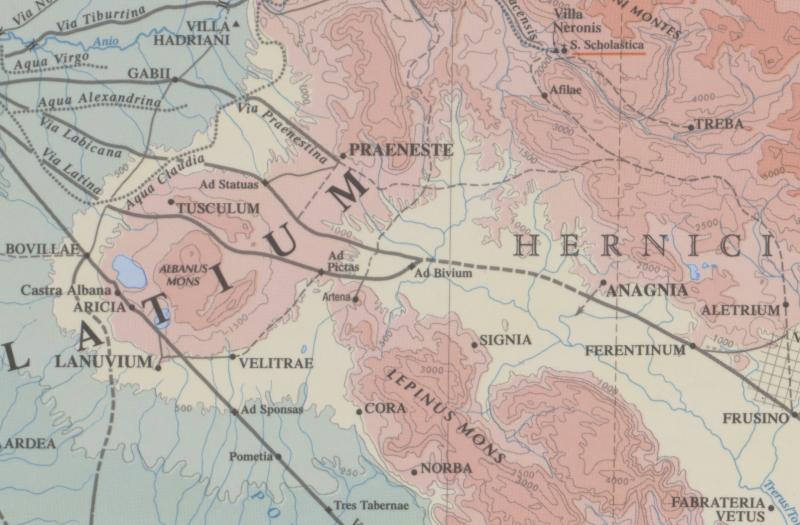
| Image (Barrington 2000) |
 |
| Image (Scheyb 1753) | --- |
| Image (Welser 1598) | --- |
| Image (MSI 2025) | --- |
| Pleiades: | https://pleiades.stoa.org/places/422805 |
| Area: | Italy |
| Toponym Type: | Toponym with Symbol |
| Grid square: | 5B1 |
| Toponym Color: | black |
| Vignette Type : | A Twin Towers |
| Itinerary: |
|
| Alternative Name (Lexica): |
|
| Name A (RE): | ad Bivium - https://elexikon.ch/RE/III,1_553.png, Bribila - https://elexikon.ch/RE/III,1_837.png |
| Name B (Barrington Atlas): | Ad Bivium (43 D3 / 44 C2) |
| Name C (TIR/TIB/others): |
|
| Name D (Miller): | Ad birium |
| Name E (Levi): | Ad birium (A,I,4) |
| Name F (Ravennate): | Bribila (p. 71.40) |
| Name G (Ptolemy): |
|
| Plinius: |
|
| Strabo: |
|
| Dating from Toponym on TP: | Late Antiquity (from Diocletian and 4th century) |
| Argument for Dating: | Erste überlieferte literarische Erwähnung beim Geographen von Ravenna bzw. seiner spätantiken Quelle. |
| Commentary on the Toponym: |
Kommentar (Köhner) |
| References: |
[1] Desjardins, Table, p. 184, col. 1, no. 4. |
| Last Update: | 06.11.2025 11:28 |
Cite this page:
https://www1.ku.de/ggf/ag/tabula_peutingeriana/trefferanzeige_en.php?id=352 [last accessed on July 15, 2026]