
Tabula Peutingeriana – Single display of hits
| Toponym TP (renewed): | Conpito Anagnino |
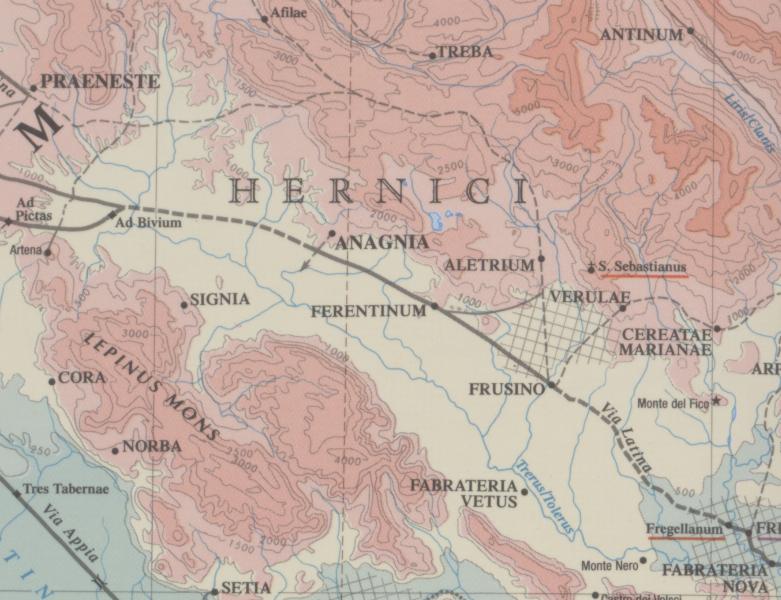
| Name (modern): | südl. v. Anagni [Pleiades] |
| Image: | 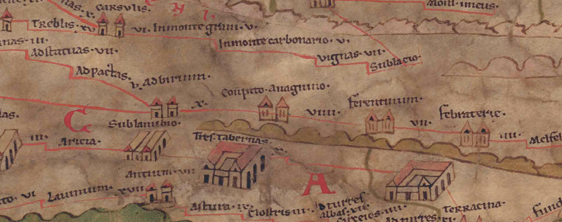 To the image detail |
| Toponym before | X Ad birium (Ad Birium) |
| Toponym following | VIIII Ferentinum |
| Alternative Image | --- |
| Image (Barrington 2000) |
 |
| Image (Scheyb 1753) | --- |
| Image (Welser 1598) | --- |
| Image (MSI 2025) | --- |
| Pleiades: | https://pleiades.stoa.org/places/422908 |
| Area: | Italy |
| Toponym Type: | Toponym with Symbol |
| Grid square: | 5B1 |
| Toponym Color: | black |
| Vignette Type : | A Twin Towers |
| Itinerary: | Compitum (305,1) |
| Alternative Name (Lexica): | Anagnia (DNP) |
| Name A (RE): | Compitum Anagninum - https://elexikon.ch/RE/IV,1_793.png |
| Name B (Barrington Atlas): | Anagnia (43 E3 / 44 C2) |
| Name C (TIR/TIB/others): |
|
| Name D (Miller): | Conpito. Anagnino |
| Name E (Levi): | Conpito. Anagnino (A,II,14) |
| Name F (Ravennate): |
|
| Name G (Ptolemy): |
|
| Plinius: |
|
| Strabo: |
|
| Dating from Toponym on TP: | Roman Imperial Period (Severan dynasty and 3rd century |
| Argument for Dating: | Die Weggabelung ist literarisch zwar schon bei Livius belegt, die mansio jedoch erst im Itinerarium Antonini, ihr Eintrag auf der Karte damit spätestens kaiserzeitlich zu datieren. |
| Commentary on the Toponym: |
Kommentar (Köhner) |
| References: |
[1] Desjardins, Table, p. 185, col. 1-2, no. 2. |
| Last Update: | 05.12.2025 09:44 |
Cite this page:
https://www1.ku.de/ggf/ag/tabula_peutingeriana/trefferanzeige_en.php?id=353 [last accessed on July 15, 2026]