
Tabula Peutingeriana – Pantalla individual
| Topónimo (simplificado): | Ocrocenaurio |
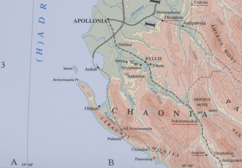
| Nombre (moderno): | near Llogara Pass [Barrington] |
| Imagen: | 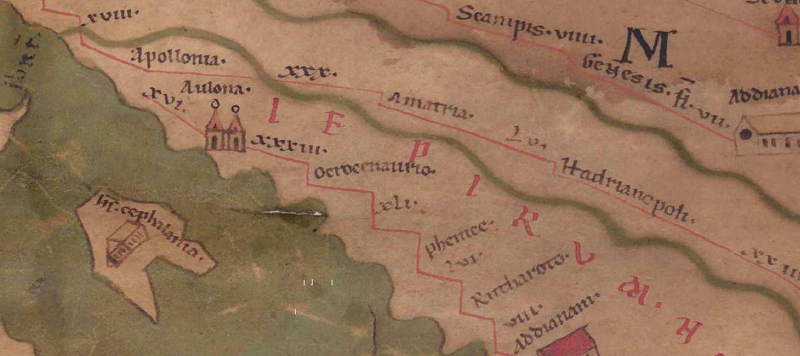 Al detalle de la imagen |
| Topónimo antes | XXXIII Aulona |
| Topónimo después | XLI Phenice |
| Imagen alternativa | --- |
| Imagen (Barrington 2000) |
 |
| Imagen (Scheyb 1753) | --- |
| Imagen (Welser 1598) | --- |
| Imagen (MSI 2025) | --- |
| Pleiades: | https://pleiades.stoa.org/places/481694 |
| Área: | Área de los Balcanes del sur |
| Tipo de topónimo: | Topónimo sin símbolo |
| Cuadrícula: | 6B3 |
| Color del topónimo: | negro |
| Tipo de viñeta: | --- |
| Itinerario: | Acroceraunia (324,3) |
| Nombres alternativos (diccionarios): |
|
| Nombre A (RE): |
|
| Nombre B (Barrington Atlas): | Ad Acroceraunia (49 B3) |
| Nombre C (TIR / TIB /otros): | Ad Acroceraunia (TIR K 34, 11) |
| Nombre D (Miller): | Ocrocenaurio |
| Nombre E (Levi): |
|
| Nombre F (Ravenate): | Acroceaurion (5,13 p. 94,35) |
| Nombre G (Ptolemaios): |
|
| Plinius: |
|
| Strabo: |
|
| Datación del topónimo en la TP: | Período Imperial (Severos y siglo III) |
| Fundamento para la datación: | Frühester Beleg der Straßenstation im ItAnt 324,3. |
| Comentario al topónimo: |
Ocrocenaurio (Abl. separativus) ist eine Verschreibung aus Acroceraunio (bzw. Ad Acroceraunia). |
| Bibliografía: |
Hammond, Nicholas: Epirus: the geography, the ancient remains, the history and the topography of Epirus and adjacent areas, Oxford 1967, 690f. |
| Última elaboración: | 15.01.2025 17:04 |
Cite this page:
https://www1.ku.de/ggf/ag/tabula_peutingeriana/trefferanzeige_es.php?id=937 [zuletzt aufgerufen am 15.10.2025]