
Tabula Peutingeriana – Einzelanzeige
| Toponym TP (aufgelöst): | Tres Tabernas |
| Name (modern): | (near Cisterna) (Miller) |
| Bild: | 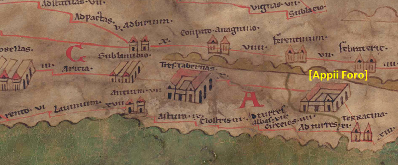 Zum Bildausschnitt auf der gesamten TP |
| Toponym vorher | - Sublanubio |
| Toponym nachher | X (unnamed/illegible, no. ID 3760) |
| Alternatives Bild | --- |
| Bild (Barrington 2000) |
 |
| Bild (Scheyb 1753) | --- |
| Bild (Welser 1598) | --- |
| Bild (MSI 2025) | --- |
| Pleiades: | https://pleiades.stoa.org/places/423106 |
| Wikipedia | https://de.wikipedia.org/wiki/Tres_Tabernae |
| Großraum: | Italien |
| Toponym Typus: | Ortsname mit Symbol |
| Planquadrat: | 5B1 |
| Farbe des Toponyms: | schwarz |
| Vignette Typus : | C Gehöft |
| Itinerar (ed. Cuntz): | Tribus Tabernis (107,3) |
| Alternativer Name (Lexika): | Tres Tabernae [1]#https://elexikon.ch/RE/IVA,2_1877.png |
| RE: | Tabernae, Tres [1] |
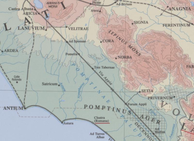
| Barrington Atlas: | Tres Tabernae (43 D3 / 44 C2) |
| TIR / TIB /sonstiges: |
|
| Miller: | Tres Tabernas |
| Levi: | Tres Tabernas (C,1) |
| Ravennat: | Tres Tabernas (p. 72.15) |
| Ptolemaios (ed. Stückelberger / Grasshoff): |
|
| Plinius: |
|
| Strabo: |
|
| Autor (Hellenismus / Späte Republik): | Tribus Tabernis (Cic. Att. 1,13; 2,10,4), ad Tres Tabernas (Cic. Att. 2,12,2) |
| Datierung des Toponyms auf der TP: | Römische Republik |
| Begründung zur Datierung: | Erste überlieferte literarische Erwähnung bei Cicero. |
| Kommentar zum Toponym: |
Kommentar (Köhner) |
| Literatur: |
[1] Crogiez 1990, 101-102) |
| Letzte Bearbeitung: | 07.11.2025 22:50 |
Cite this page:
https://www1.ku.de/ggf/ag/tabula_peutingeriana/trefferanzeige.php?id=462 [zuletzt aufgerufen am 24.07.2026]