
Tabula Peutingeriana – Single display of hits
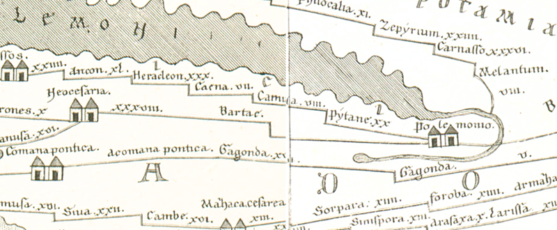
| Toponym TP (renewed): | Bartae |
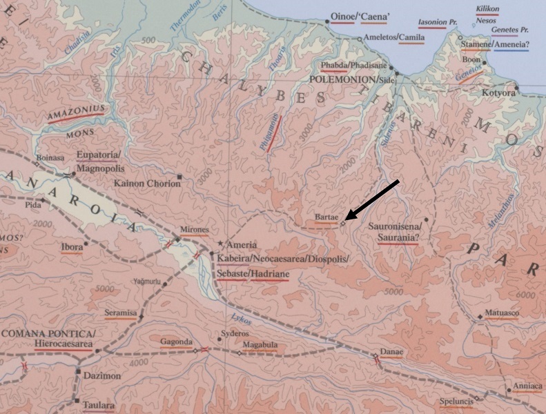
| Name (modern): | ? bei Aşağı Yaylacık oder Yukarı Yaylacık, ehemals Batarı in der Nähe von Korgan ? |
| Image: | 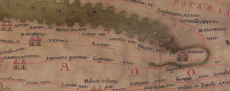 To the image detail |
| Toponym before | XXXVIII Neocesaria |
| Toponym following | - Polemonio |
| Alternative Image | --- |
| Image (Barrington 2000) |
 |
| Image (Scheyb 1753) |
 |
| Image (Welser 1598) | --- |
| Image (MSI 2025) | --- |
| Pleiades: | https://pleiades.stoa.org/places/857057 |
| Area: | Asia Minor |
| Toponym Type: | Toponym, no Symbol |
| Grid square: | 9A3 |
| Toponym Color: | black |
| Vignette Type : | --- |
| Itinerary: |
|
| Alternative Name (Lexica): |
|
| Name A (RE): | Bartae |
| Name B (Barrington Atlas): | Bartae (87 C4) |
| Name C (TIR/TIB/others): |
|
| Name D (Miller): | Bartae |
| Name E (Levi): |
|
| Name F (Ravennate): |
|
| Name G (Ptolemy): | ? = Βαρβάνισσα (5,6,10) |
| Plinius: |
|
| Strabo: |
|
| Dating from Toponym on TP: | Roman Imperial Period (2nd century) |
| Argument for Dating: |
Unsicher; die Datierung setzt voraus, dass die Identifizierung mit Βαρβάνισσα bei Ptol. zutrifft, was dann der früheste Beleg des Ortes wäre. |
| Commentary on the Toponym: |
Ortsname sonst nicht belegt. |
| References: |
Bryer, W./Winfield, D.: The Byzantine Monuments and Topography of the Pontos 1, Washington 1985, 42; 116. |
| Last Update: | 18.08.2025 13:17 |
Cite this page:
https://www1.ku.de/ggf/ag/tabula_peutingeriana/trefferanzeige_en.php?id=1367 [last accessed on June 4, 2026]