
Tabula Peutingeriana – Single display of hits
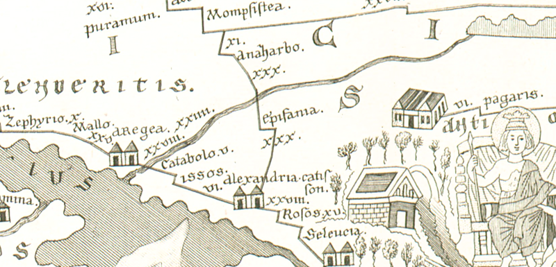
| Toponym TP (renewed): | Catabolo |
| Name (modern): | ? Muttalip Höyüğü |
| Image: | 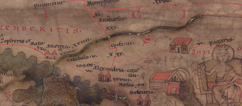 To the image detail |
| Toponym before | XXIIII Mompsistea XXVIII Aregea |
| Toponym following | V Issos |
| Alternative Image | --- |
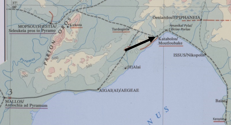
| Image (Barrington 2000) |
 |
| Image (Scheyb 1753) |
 |
| Image (Welser 1598) | --- |
| Image (MSI 2025) | --- |
| Pleiades: | https://pleiades.stoa.org/places/658506 |
| Area: | Asia Minor |
| Toponym Type: | Toponym, no Symbol |
| Grid square: | 9B4 |
| Toponym Color: | black |
| Vignette Type : | --- |
| Itinerary: | Catabolo (146,1); Catavolo (580,6) |
| Alternative Name (Lexica): |
|
| Name A (RE): |
|
| Name B (Barrington Atlas): | Katabolos/Moutloubake (67 B3) |
| Name C (TIR/TIB/others): | Mutlubake (TIB 5, 361f) |
| Name D (Miller): | Catabolo |
| Name E (Levi): |
|
| Name F (Ravennate): | Catavolon (p. 28,3); Cabulon (p. 90,35) |
| Name G (Ptolemy): |
|
| Plinius: |
|
| Strabo: |
|
| Dating from Toponym on TP: | Roman Imperial Period (Severan dynasty and 3rd century |
| Argument for Dating: | 2. H. 3. Jh. Erste Erwähnungen in den Res gestae Divi Saporis 24 (260 n. Chr.) und im ItAnt. |
| Commentary on the Toponym: |
Erste Erwähnung des Ortes: Res gestae Divi Saporis 24 (260 n. Chr.). |
| References: |
Akpinar, Ezgi: Hellenistic and Roman Settelement Patterns in the Plain of Issus and the Amanus Range, Master thesis Ankara 2004, 33f. |
| Last Update: | 24.08.2025 22:58 |
Cite this page:
https://www1.ku.de/ggf/ag/tabula_peutingeriana/trefferanzeige_en.php?id=1449 [last accessed on July 4, 2026]