
Tabula Peutingeriana – Single display of hits
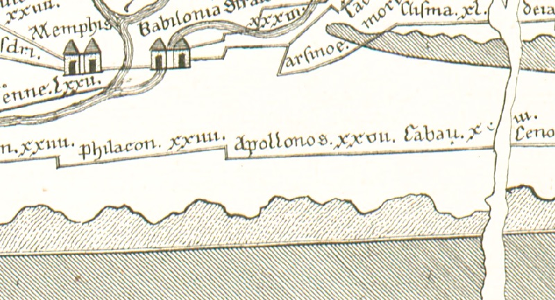
| Toponym TP (renewed): | Apollonos |
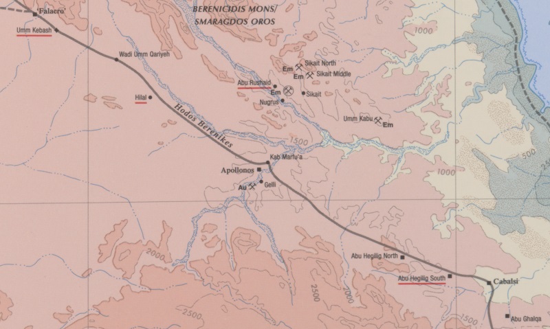
| Name (modern): | Wadi Gemal (Barrington) |
| Image: | 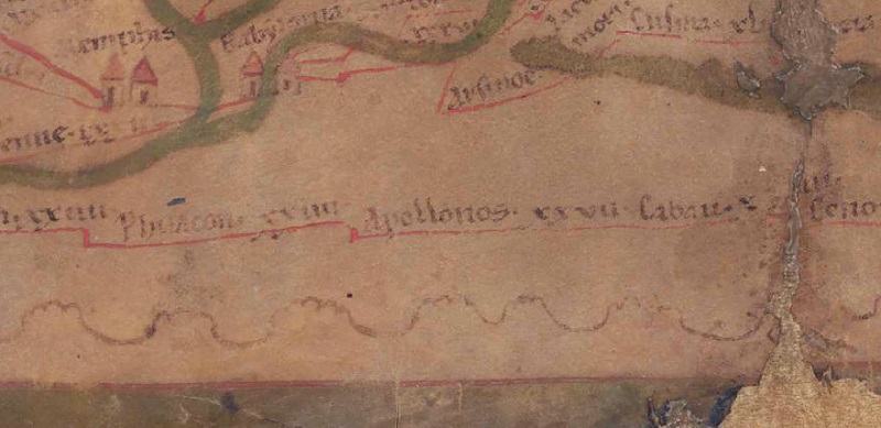 To the image detail |
| Toponym before | XXIIII Philacon |
| Toponym following | XXVII Cabau |
| Alternative Image |
 |
| Image (Barrington 2000) |
 |
| Image (Scheyb 1753) | --- |
| Image (Welser 1598) | --- |
| Image (MSI 2025) | --- |
| Pleiades: | https://pleiades.stoa.org/places/785976 |
| Area: | Egypt/Nile/Ethiopia |
| Toponym Type: | Toponym, no Symbol |
| Grid square: | 8C4 |
| Toponym Color: | black |
| Vignette Type : | --- |
| Itinerary: | (173,1) |
| Alternative Name (Lexica): | Hydreuma Apollinis (Plin. nat. 6,102) |
| Name A (RE): | Apollinis hydreuma |
| Name B (Barrington Atlas): | Apollonos (80 F4) |
| Name C (TIR/TIB/others): |
|
| Name D (Miller): | Apollonios |
| Name E (Levi): |
|
| Name F (Ravennate): | Appollonos (p. 20.22) |
| Name G (Ptolemy): |
|
| Plinius: |
|
| Strabo: |
|
| Dating from Toponym on TP: | Early Empire (including Flavian period) |
| Argument for Dating: | Den ältesten Beleg für Apollonos liefert Plinius, der aber das Toponym Hydreuma Apollinis bietet. |
| Commentary on the Toponym: |
Den ältesten Beleg für diese Station liefert Plinius, für das 3.Jh.; heranzuziehen ist vielleicht O. Sam. inv. 720 mit der Nennung eines Funktionärs ἐπὶ τοῦ Ἀπολλωνίου, dessen Verantwortungsbereich also möglicherweise Ἀπόλλωνος Ὕδευμα ist. Sidebotham (2008, 301) vermutet, dass die Bedeutung von Apollonos in der Überwachung der Smaragdminen bestanden habe, was Cuvigny aber mit dem Hinweis auf die zu große Entfernung (20 km) der Abbaugebiete und der dortigen Arbeitersiedlung für unwahrscheinlich hält. - Vgl. auch zu Hormucopto·. |
| References: |
Miller, Itineraria, Sp. 862; |
| Last Update: | 30.12.2024 12:20 |
Cite this page:
https://www1.ku.de/ggf/ag/tabula_peutingeriana/trefferanzeige_en.php?id=2831 [last accessed on May 28, 2026]